Using Machine Learning Models to Find Underground Moving Water
Subsurface water movement can be located with deep learning and natural electrical fields.
May 29, 2026
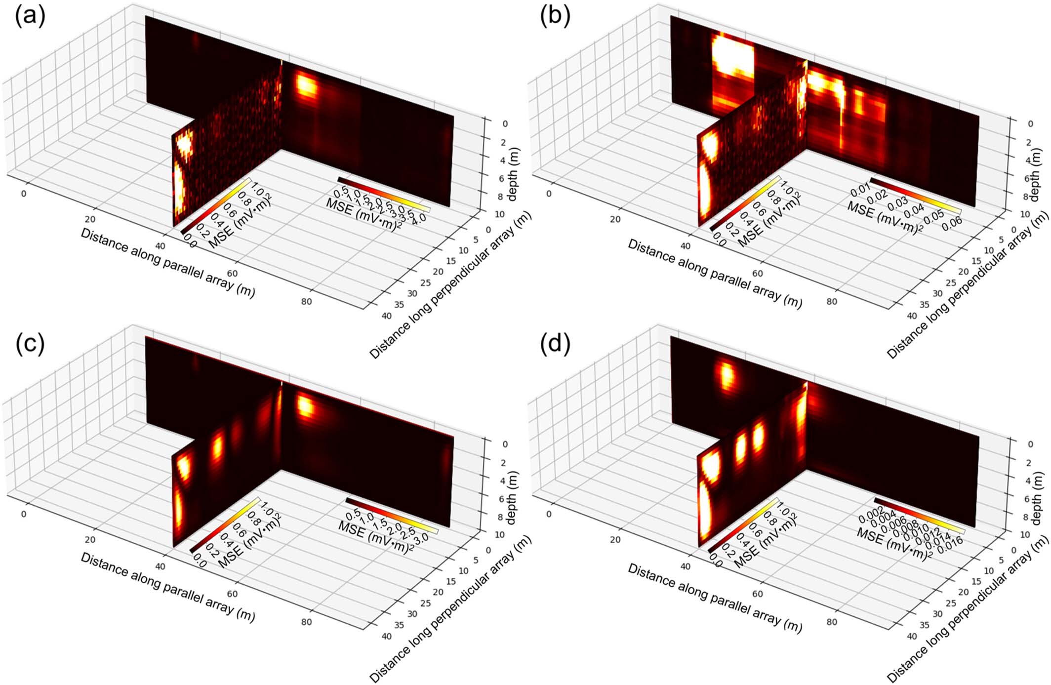
Anomalies (yellow-to-white color) in machine learning reconstructions of self-potential tomographies are indicative of locations with moving water. (a and c) Single-date images. (b and d) Average anomalies for data collected over 6 months.
[Reprinted under a Creative Commons Attribution-NonCommercial-NoDerivatives 4.0 International License (CC BY-NC-ND 4.0) from Yin, H., et al. 2026. “Localization of Spatiotemporally Heterogeneous Subsurface Flows Using Autoencoder-Based Deep Learning Framework for Time-Lapse Self-Potential Tomography,” Journal of Geophysical Research: Machine Learning and Computation 3(3), e2025JH001208. DOI:10.1029/2025JH001208.]
The Science
In a new study, a team of researchers measured natural electric fields created as water moves through the ground. The resulting dataset, collected over 6 months, included more than 10 million measurements. Researchers then developed a machine learning method to help interpret the data and identify places in the underground where water was moving. Using these methods, moving water was consistently detected near an underground break or crack in the rock.
The Impact
Understanding how water moves underground is crucial for managing water resources and predicting environmental change. However, collecting and interpreting the needed data is difficult due to complex properties of soils and rock and changes over time and location. This work demonstrates consistent locations of water movement can be identified using machine learning methods to help interpret data.
Summary
Self-potential (SP) signals, natural electrical fields generated as water flows through the ground, are a valuable method for understanding subsurface water movement. However, interpreting SP data is challenging due to the complex underground environment and the presence of short-term noise.
A team of researchers developed a deep learning method to help analyze SP data collected from a floodplain in Oak Ridge, Tenn., where stream water interacts with underground rock layers. Researchers first converted raw SP measurements into a series of SP tomography frames showing the estimated flow patterns over time. The team then trained deep learning models called autoencoders to learn what normal SP patterns look like, so the models could detect times of unusual changes based on reconstruction errors. Spatial patterns of these errors were analyzed to locate potential zones of subsurface fluid flow. Among the models tested, those based on vision transformer and convolutional long short-term memory autoencoders performed best. Identified zones of active water movement were consistently located near a fault or karst feature and were observed across multiple monitoring lines, confirming the method’s reliability for mapping underground water flows.
References
Yin, H., S. J. Ikard, D. F. Rucker, S. C. Brooks, Z. Dai, M. R. Soltanian, and K. C. Carroll. "Localization of Spatiotemporally Heterogeneous Subsurface Flows Using Autoencoder-Based Deep Learning Framework for Time-Lapse Self-Potential Tomography." Journal of Geophysical Research: Machine Learning and Computation 3 (3), e2025JH001208 (2026). https://doi.org/10.1029/2025JH001208.